Drainage Basins at Varying Scale
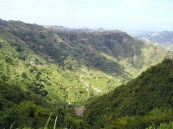
Drainage basins vary in size from single valley catchments, which might show a typical v-shaped form to vast international scale drainage basins like the Amazon. It's possible to study and classify single rivers, each with their own catchment. A tributary with no feeder stream is referred to as a 1st order stream. However if two or more 1st order streams feed into a larger stream then that stream becomes a 2nd order stream. Likewise, if two 2nd order streams feed into another stream then that stream becomes a 3rd order stream. The Mississippi is a 10th order stream whilst the largest order stream is the River Amazon, considered to be 12th order.
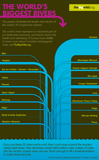
The World's Largest Rivers
The graphic below shows the world's largest rivers in terms of both river length and discharge. The world's two longest rivers are the Nile and the Amazon, 6693km and 6436km respectivley. The Amazon has by far the largest discharge feeding 175 000 cubic meters of water into the Atlantic every second.
Varying Scale
We can see in the map below, the six major catchments that feed water into the Mississippi. In this map we can see that the Mississippi is by far the largest (in discharge) river system in the USA. It dominates the US landscape and can be considered a 'primate river'. This is because it's shear scale dwarfs the second largest river of the US, the Ohio. 593 cubic feet per second comopared 281 cubic feet per second. Interestingly the longest river in the USA is the Missouri, which flows as a feeder river into the Mississippi.
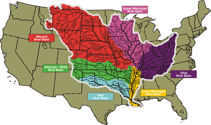
Source: Mississippi River Commission

UK overlay with USA
|
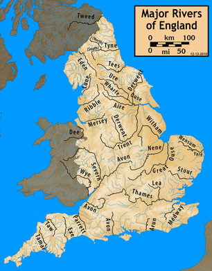
The US's river landscape contrasts with the UK. As we can see there is no single primate river in the UK. There are several evenly sized rivers that drain the landscape. This is not unusual for a small island country of the UK's size. In addition the drainage density is similar to that of the Mississippi. As you see from the overlay the UK is smaller than the state of Oklahoma and would only represent a part of the Red River Basin.
|
